Using Te Ara -
The Encyclopedia of New Zealand
1. Waitemata Harbour
L.I. Develop our knowledge of Auckland and the Tamaki River.
Familiarise ourselves with an online NZ encyclopaedia.
Use our skimming and scanning skills.
Enter Waitemata into the search box and use that page to answer these questions.
What sort of landform is the Waitemata harbour?
The Waitematā Harbour (also known as Auckland Harbour) is a drowned river valley, stretching from Riverhead in the north-west to Tāmaki River in the east.
Why was it chosen to be New Zealand’s capital?
The harbour’s deep navigable channels and sheltered bays helped to determine Lieutenant-Governor Hobson’s choice of a site for New Zealand's capital in 1840
What does Waitemata mean?
Waitemata was a New Zealand parliamentary electorate, from 1871 to 1946, and then from 1954 to 1978
Tell me one interesting fact about each of these features of the Waitemata:
Wai-te-matā means ‘obsidian waters
Auckland’s chief port -Auckland’s port on the Waitematā was vital to the progress of the city and region
Viaduct basin -The site of the old fishing harbour,was redeveloped in the 1990’s
to 2003.
Westhaven -
Other marinas have been constructed around the harbour. On Auckland Anniversary Day each year the Auckland Regatta (the largest one-day regatta in the world) fills the harbour with sails.
Harbour bridge -
The Auckland Harbour Bridge (1,020 m long) was opened in 1959 to link the Auckland isthmus with the north.
Greenhithe bridge -The Greenhithe Bridge was built in 1975 as an alternative harbour crossing, spanning the upper Waitematā from Hobsonville to Greenhithe on the North Shore.
Natural features -Natural features of the Waitematā include Meola reef (also known as The Tokoroa, meaning ‘a long reef’), a rocky submarine promontory.
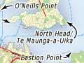
Copy the map here
No comments:
Post a Comment